Data Overview
The Fire Event Data Suite (FEDS) algorithm (Chen et al., 2022) uses an alpha shape approach to estimate the perimeter and properties of ongoing fire events every 12 hours, based on Visible Infrared Imaging Radiometer Suite (VIIRS) 375 m active fire detections (Figure 1).
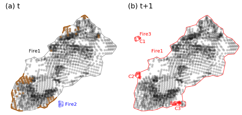
The FEDS algorithm clusters active fire detections into individual events, estimates the fire perimeter and fire characteristics, and tracks fire growth for each 12-hour time step. The vector data product includes multiple attributes for each estimated perimeter, including the active portion of the fire perimeter and metrics of fire behavior for each 12-hour growth increment. The FEDS algorithm inherits the spatial resolution and geolocation accuracy of the VIIRS 375 m active fire product from the Suomi-NPP and NOAA-20 satellites and estimates the fire perimeter every 12 hours to generate a vector output. For all fire events, regardless of fire size or duration, the FEDS algorithm provides a “snapshot” of the fire perimeter every 12 hours. For fires that ultimately grow larger than 4 km2, these modeled perimeters and associated attributes are stored in sequence to track the growth and behavior of each large fire event.
The estimated perimeter data are routinely produced within approximately four hours of each VIIRS overpass for the Continental United States (CONUS) and Canada.